What is the Photogrammetry?
Definition
Digital photogrammetry is a process of digitalisation of information by which it is possible to reconstruct morphologically, volumetrically and chromatically a physical element such as the terrain, objects or constructions. By transforming the 2D metric information contained in the photographs, such as space and depth as well as texture, processing and converting it into 3D information, obtaining as a result point clouds that represent the above values.
How is it done?
Photogrammetry can be categorised as aerial or terrestrial depending on the means and tool used to develop the fieldwork, firstly, it is developed using a camera in the case of terrestrial or a drone equipped with a camera in the case of aerial.
Digital photogrammetry is based on a computation performed by specialised software that transforms the 2D information collected in the photographs and converts them into 3D, adding additional values such as volume or depth.
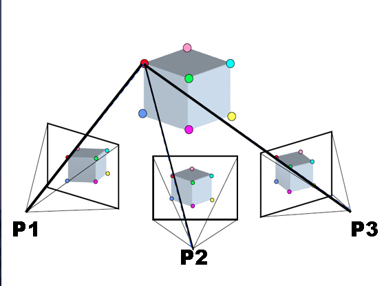
The main computational tool is carried out by finding homologous points in the different photographs, through this process the relative distances between the point and the photogrammetrist are calculated, in order to triangulate and assign a coordinate on the X and Z axes to that point.
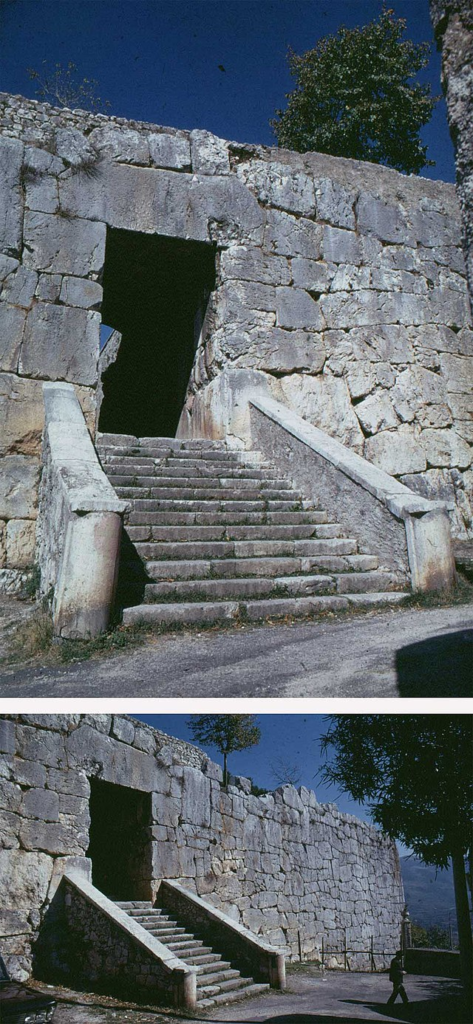
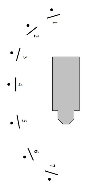
The photographs taken of the object, property, building or land in question are loaded into a special program where the computation is developed, creating homologous points by overlapping the photographs, taken with concise angles and shots to correctly develop their union, interspersing perfectly visible parts that serve the program to select and compile them, thus creating the overlapping areas. These overlapping areas are the common zones and parts existing between 2 or more photographs.
The programme creates homologous points by analysing these common areas of overlap, selecting common points. The more times a point is collected, the more accurately it is represented, and the process is carried out as shown in the images below.
An overlap of more than 70% is always recommended in order to make the process of linking and processing points more efficient.

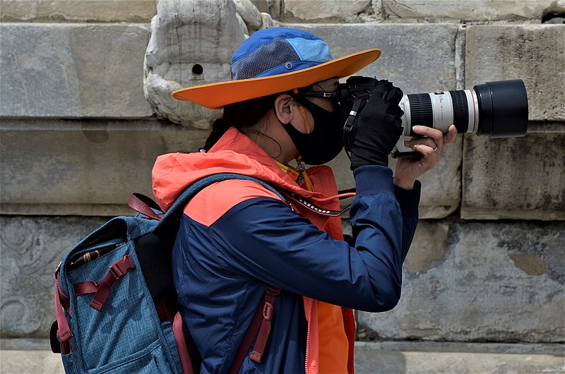
- Fieldwork: The 2D photographs can be taken on site or in a studio under controlled conditions.
- Tools. Depending on the tool used for data collection, it can be mainly aerial with the use of e.g. drones or terrestrial with a reflex camera.
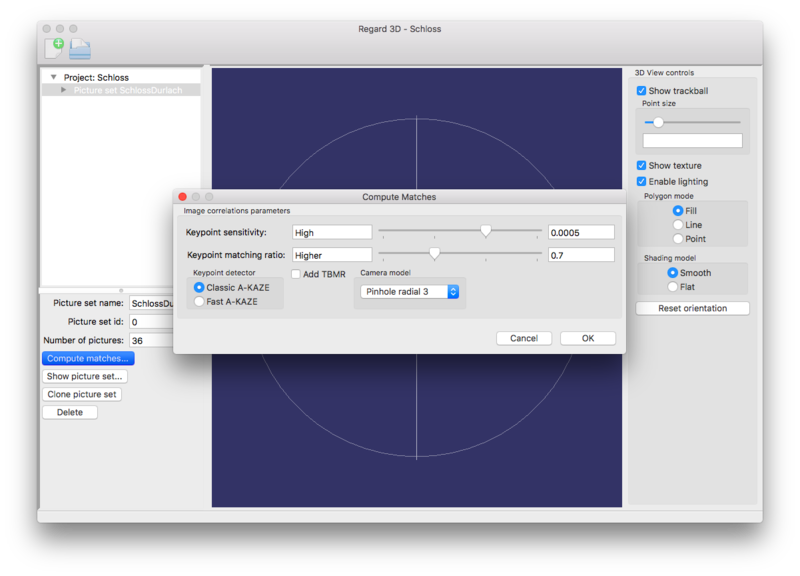
- Office work: This is carried out after obtaining data, with the help of computer equipment and specialised software, by means of which the processes of obtaining magnitudes and assembling three-dimensional information are carried out.
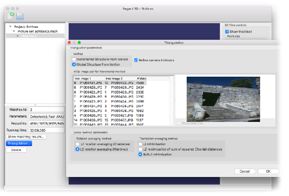
- Tools: These can be point cloud assembly software, editing software and other programmes that allow work for different uses.
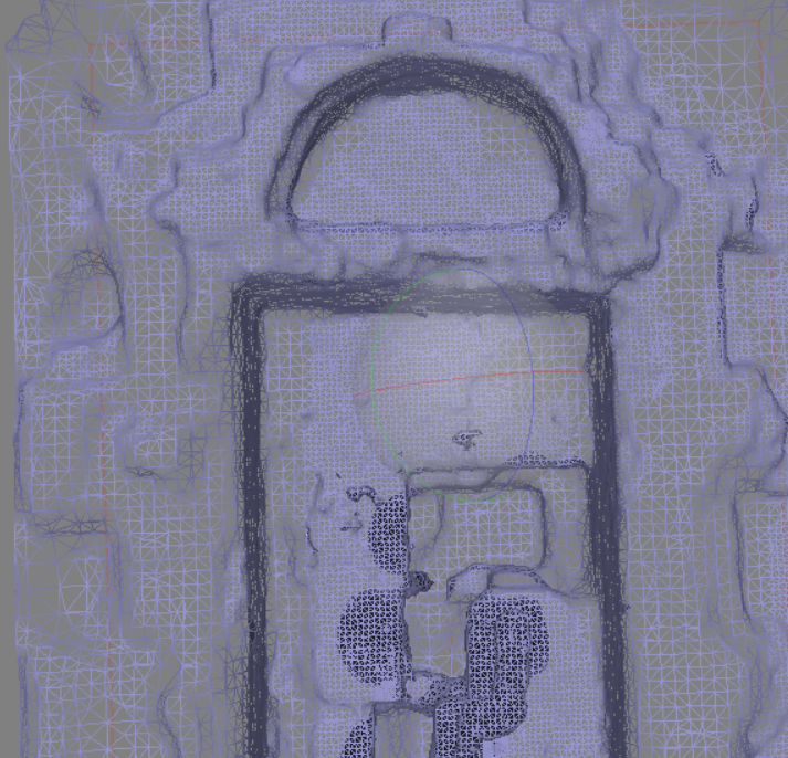
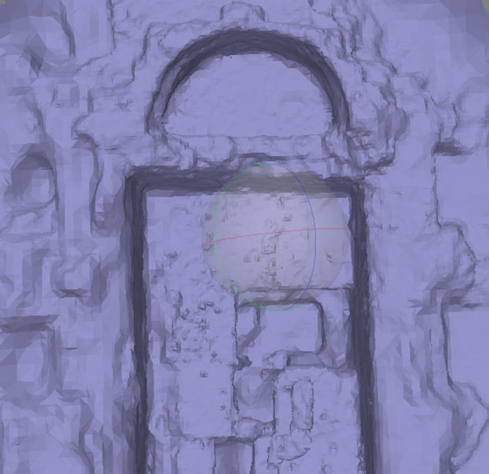
The results obtained immediately after the previous image processing are first of all the so-called point cloud, where the homologous points found are displayed and derived from this, it is possible to create the so-called polygon mesh, which is the unified and solid representation of the point cloud.
Point cloud
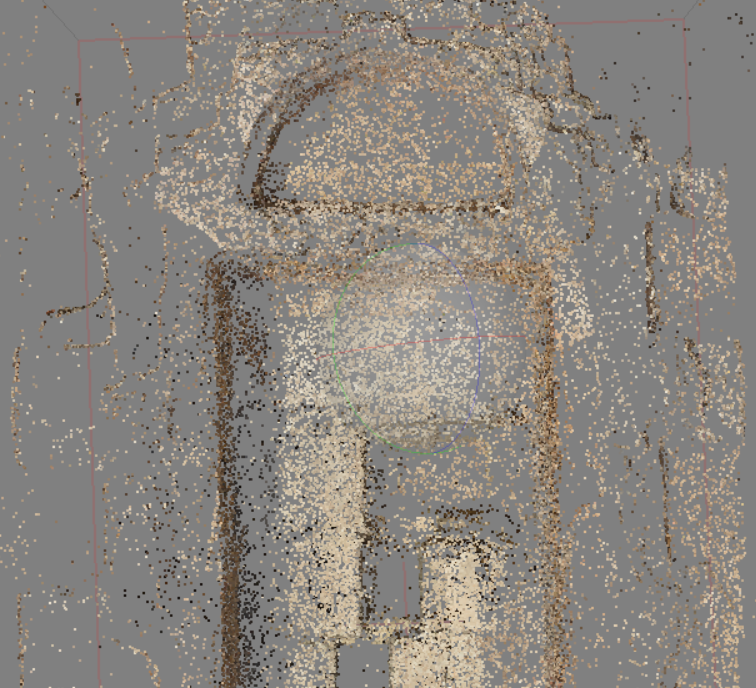
Set of homologous points documented in the photograph with X,Y,Z coordinates.
Polygonal mesh
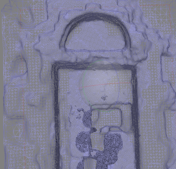
Union of homologous points acting as vertices, coherently joining together, creating a polygonal figure with surfaces.
Point cloud:
The capture of reality by photogrammetric programmes can generate, contrary to the results of a laser scanner, the subdivision of the process of obtaining a point cloud in two, a simpler primitive one and a dense one formed by a greater number of points.
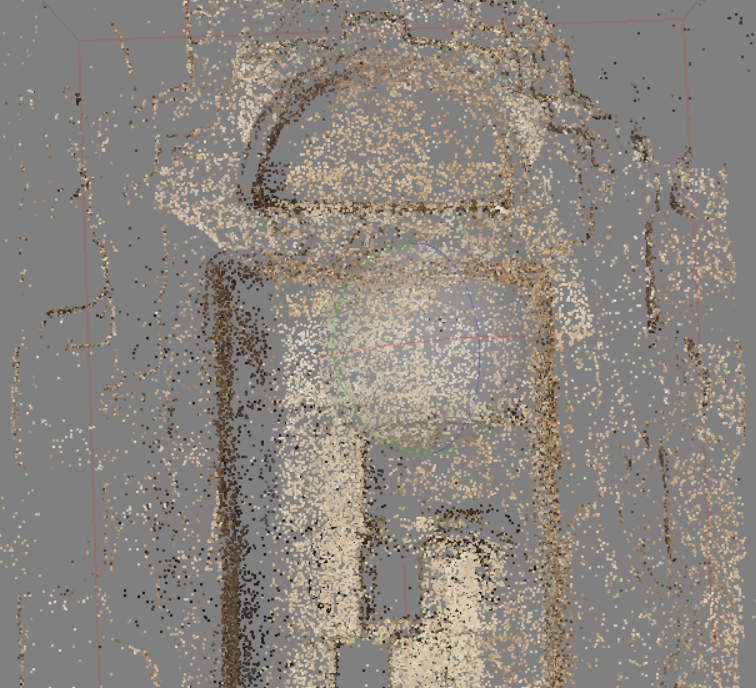
First point cloud, resulting from the alignment of the processed images.

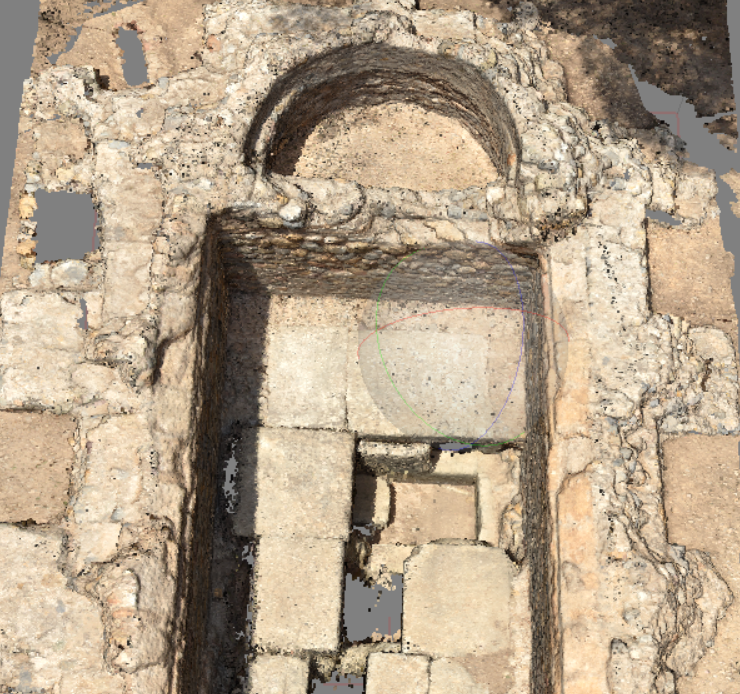
Densified point cloud, by triangulating new points in relation to and on top of the previous cloud.
Polygon mesh process:
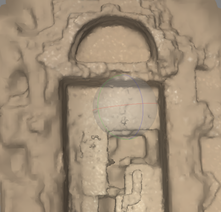
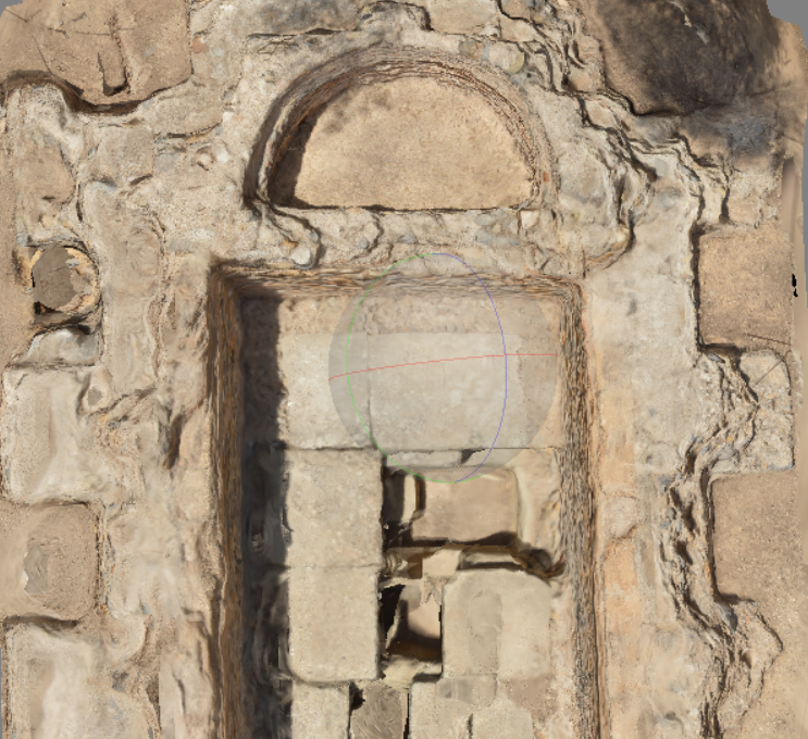
The polygon mesh is made up of a large number of homologous points that form the vertices of the polygons that make up the mesh, these polygons can acquire different shapes, as well as filling their faces, colouring them and texturing them according to the pixels of the processed images.


New technologies for obtaining 3D data
Cameras
Cameras: Cameras are the main tools used within the photogrammetric technique, these are responsible for capturing images taken from angles and concise positions to obtain from them the subsequent 3D documentation.
The Mobile phone cameras or the commonly used reflex cameras are the main tools of photogrammetry. Photographs must be taken with a specific methodology so that there is an overlap of more than 70%, so each photograph must capture 70% old information and 30% new information. This gradual pattern to be applied until the last cm of the element to be documented is captured.
Lenses:
One of the main mechanisms of cameras are the lenses or photographic objectives, these parts are usually the most striking of the whole camera, usually consist of a cylindrical plastic shape topped with a glass on its outer base, this is the lens, a simulation of the human eye. Lenses can be interchangeable in SLR cameras and is one of the most important parts of the camera’s operation and on it depends largely both the effect and the quality of the image captured.
Without the camera lens and its lens, the rest of the mechanism could only capture the ambient light, this is where we find the term photographic focal length, this is measured in mm and is the representation of the distance between the sensor and the lens, so the longer the distance the smaller field of view is possible to capture, as it is the manual zoom is the one that can adapt this magnitude within the parameters of the lens.
Lenses for photogrammetry:
Zoom Lenses: Zoom lenses, are the most consumed throughout the world, because the big companies have manufactured these lenses as a default item for the sale of their cameras, these are lenses adaptable to lighting conditions, have a good image quality, are easy to use.
Fixed Lenses: These are fixed lenses, which have a single focal length so they cannot physically zoom, they are lenses that capture a large amount of light, which makes them able to work efficiently in places with low illumination.
The 50mm fixed lenses are the most used in the photogrammetric field because of the little field distortion they produce, while other lenses such as wide angle or fisheye are discarded from photogrammetric use, because they obtain the opposite effect.
Exposure:
The exposure in a photographic camera, is the amount of light that the camera’s sensor receives, different variables depend on it that each one in a different way, adjust and mismatch the light composition that is applied to the capture, this has repercussions in colors, illumination or brightness.
There are different editing modes for the realization of the photographic capture:
P: Automatic.
A/AV: Aperture Aperture.
S/TV: Shutter speed.
M: Manual.
ISO can be changed in each capture mode.
The variables are dependent on each other, a good photograph is based on the optimum point of calibration of the variables according to the light conditions of the environment, these are represented in the so-called exposure triangle.
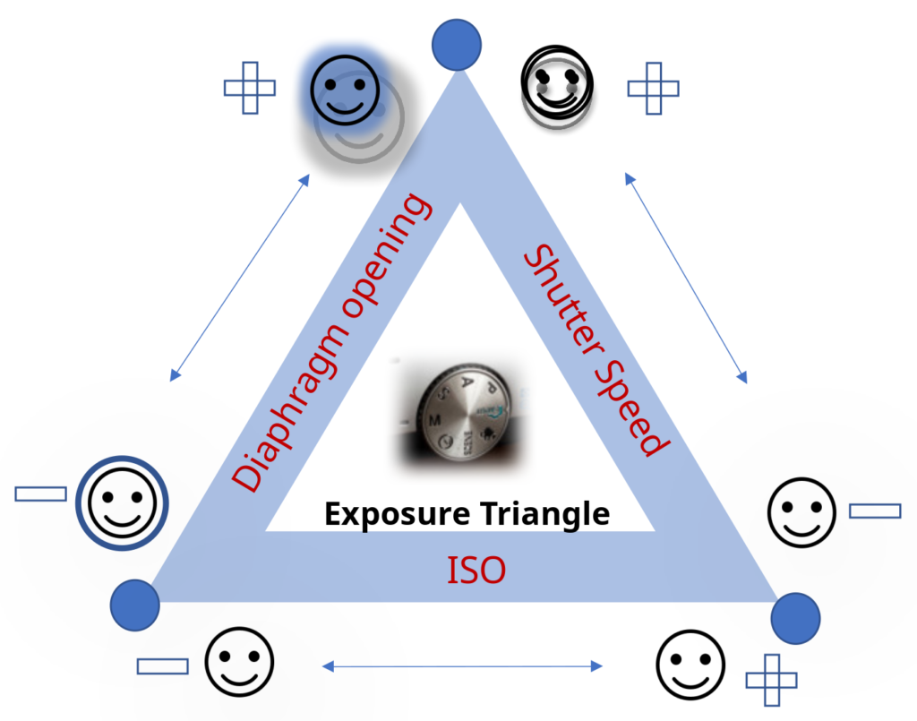
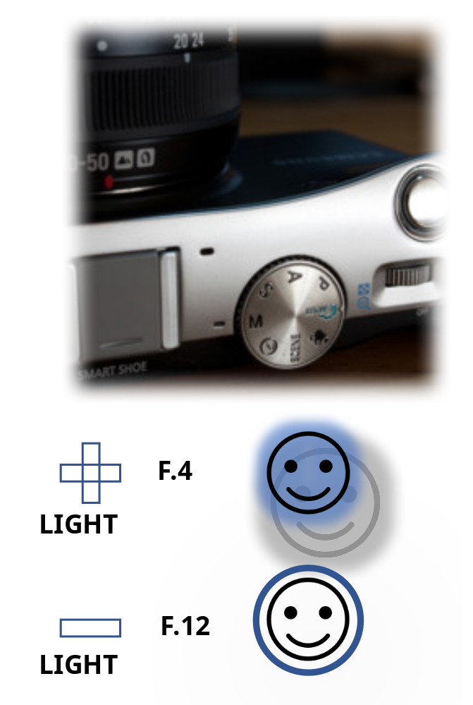
Diaphragm Aperture: It has a direct relationship with light, it consists of the opening and closing action of the lens to control the amount of light that passes through it.
The photographic or diaphragm aperture is calculated in f-stops and its numbering is indirectly proportional to the amount of light it lets through, for example an F.12 lets less light through than an F.4 configuration.
The choice of aperture is of great importance for photogrammetry, on it depends mainly the future calculation of depths. The photographic aperture is also directly related to the depth of field captured in the image, because the larger the aperture of the lens, the more blur it will have on the elements that are not captured in the foreground, distorting all the elements that are behind it; the smaller it is, the better focus it will have and therefore the greater sharpness we will find in the representation of all the depths and distances.
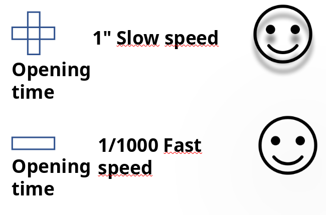
Shutter speed: It has a direct relationship with the shutter mechanism, a mechanism that opens and closes inside the camera to allow light to enter the camera, the speed at which it performs the manoeuvre is variable and has an impact on the shutter speed. The shutter speed is measured in fractions of seconds, although it can also be implemented with whole seconds.
It therefore affects the exposure of the sensor in the following way:
- Rapidly repeated manoeuvre: The shutter is kept open for a shorter period of time, which allows less light to pass through and produces a darker picture.
- Slowly repeated manoeuvre: The longer the shutter is held open, the more light it lets through and the brighter the picture.
If the shutter is kept open for too long, it can degenerate the picture with the slightest movement of the camera.
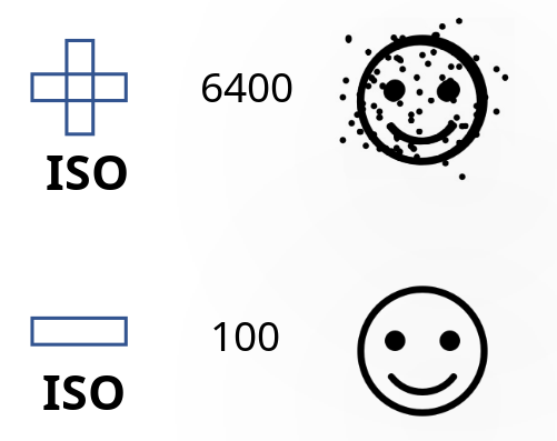
Photographic ISO: It is a direct exposure variable of the sector’s sensitivity to light, so it has a value of darkening and lightening the photograph.
By increasing the ISO the sensor will be more sensitive to light, so it is possible to capture images in dark environments.
In environments with a lot of natural light, it is possible to use minimum ISO, if there is shade 200 increasing according to the darkness, but always as a last resort, because abusing the ISO can considerably worsen the quality of the image, encourage the appearance of graininess and distortion of colours and textures.
Automatic mode: The automatic mode of the cameras takes light references and adapts the variables to the existing light conditions, in order to obtain the best results in the photographic captures.
If the variables are not well calibrated, it is possible to find different scenarios such as overexposure, where the composition will be too bright, with an increase in brightness, or the opposite result, underexposure, where the light will lack the amount of illumination and a proliferation of shadows will be captured.

Drone
Drones: Camera-equipped drones have similar patterns to the above. They are very useful work tools, these unmanned flying devices allow data to be obtained from the air.
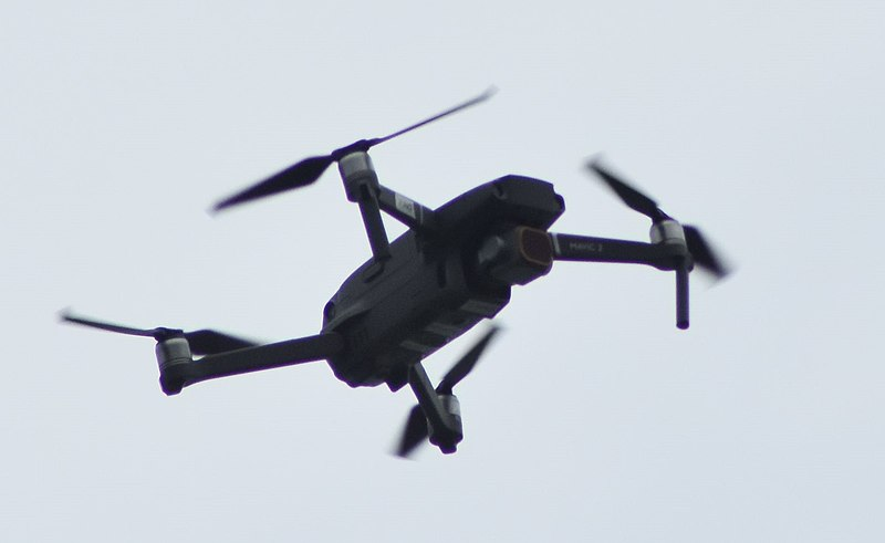
The main types of drones are fixed-wing and multi-rotor drones. Drones can carry an RGB, Thermal or Lidar camera, as well as a combination of aerial and terrestrial point clouds, for example, point clouds created by a terrestrial laser scanner and a photogrammetric cloud generated by a drone.
The drone can fly and take pictures with manual control of the controller, but there are programmes and applications for mobile devices such as tablets or smartphones to link the controller and the drone, serving as support for different types of flight missions.
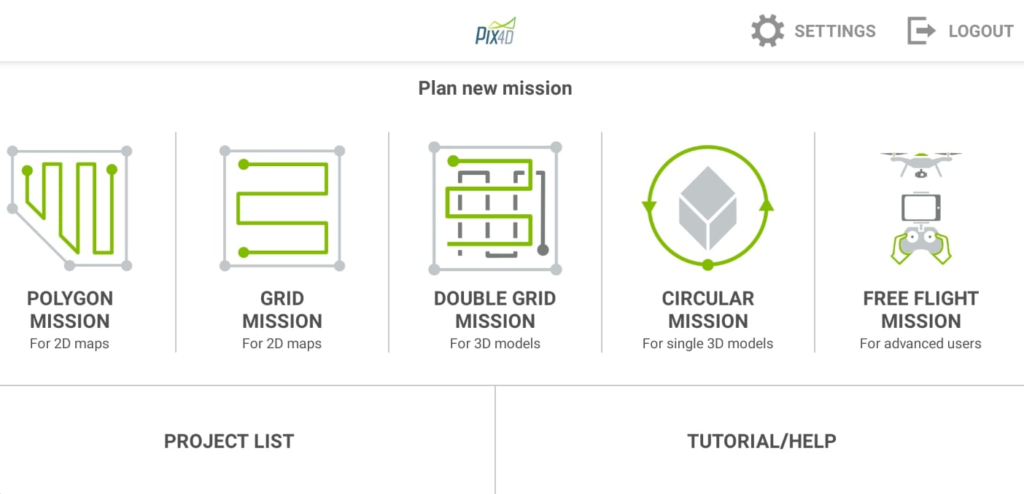
Mission plans with selected and premeditated routes through a virtual map, where it is possible to choose the flight mode, altitude and amount of photographic captures desired, among other options.
Software
Software: There are different types of software for assembling, managing and editing different types of content and 3D elements. Some of these programmes are specialised in aerial photogrammetry only or even allow the computation of data obtained by different photogrammetric techniques in conjunction with data digitised with laser scanners. Another type of existing software is the management and editing software, although the previous ones have basic tools to edit the obtained 3D results, these softwares have more options for editing and obtaining data.
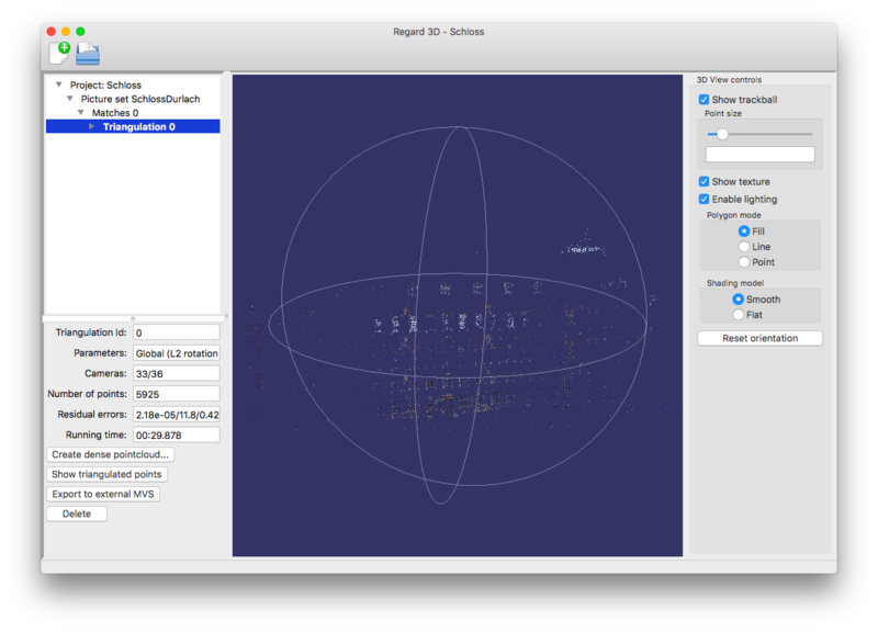
Post-processing software: After obtaining the three-dimensional resource by processing the information from the captured images, it is possible that the result obtained is not entirely satisfactory or that the programme we have used lacks a large number of advanced tools for managing and editing meshes or point clouds, so it is a good idea to post-process the three-dimensional resource, and we can obtain great results such as improving the texture, simplifying the point cloud, subjecting it to reordering or improving the texture.
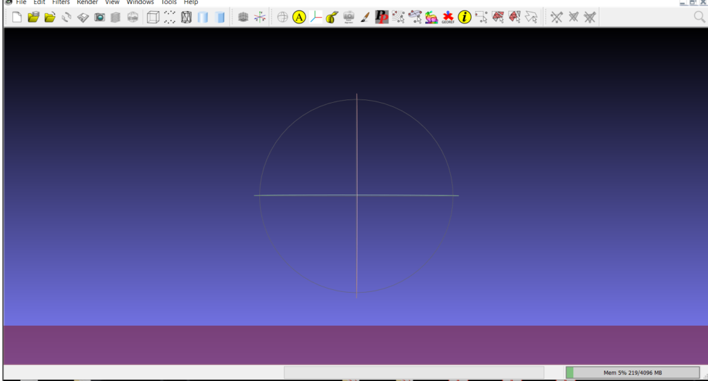
Free programmes such as Meshlab help us to improve our three-dimensional resources to the maximum.
New Visualisation and Dissemination Technologies
New visualisation and dissemination technologies Dissemination platforms, there are online platforms that allow the upload and visualisation of 3D elements of different types. These elements can be displayed on these platforms for multiple reasons, either for enjoyment, advertising or to show the services that can be offered, cultural and scientific dissemination, teaching…
Dissemination, photogrammetry in society. A large part of the photogrammetric processes have been automated thanks to new technologies, which has made it possible for it to be used by non-professional users, who practice this discipline as a hobby, creating a worldwide community.
Click on the images to access their content


